wolfhece.RatingCurve
Author: HECE - University of Liege, Pierre Archambeau
Date: 2024
Copyright (c) 2024 University of Liege. All rights reserved.
This script and its content are protected by copyright law. Unauthorized
copying or distribution of this file, via any medium, is strictly prohibited.
Module Contents
-
wolfhece.RatingCurve.msg[source]
-
wolfhece.RatingCurve.POLYNOMIAL_LAW = 0[source]
-
wolfhece.RatingCurve.POWER_LAW = 1[source]
-
wolfhece.RatingCurve.FMTDATEMI = '%d-%m-%y'[source]
-
wolfhece.RatingCurve.FMTDATE = '%d/%m/%Y %H:%M:%S'[source]
-
wolfhece.RatingCurve.FMTDATEG = '%d-%m-%y%H:%M'[source]
-
wolfhece.RatingCurve.FMTDATEG2 = '%d-%m-%Y %H:%M'[source]
-
wolfhece.RatingCurve.FMTDATE2 = '%d/%m/%Y'[source]
-
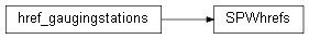
class wolfhece.RatingCurve.href_gaugingstation(id: int, name: str, basin: str, hDNG)[source]
-
id: int[source]
-
name: str[source]
-
basin: str[source]
-
hDNG: float[source]
-
class wolfhece.RatingCurve.href_gaugingstations(fromxls: str = '')[source]
-
myhrefs: list[source]
-
class wolfhece.RatingCurve.gauging(id: int, name: str, basin: str, Q: float, H: float, date: datetime.datetime)[source]
-
id: int[source]
-
name: str[source]
-
basin: str[source]
-
Q: float[source]
-
H: float[source]
-
date: datetime.datetime[source]
-
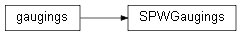
class wolfhece.RatingCurve.gaugings(fromxls: str = '')[source]
-
mygaugings: list[source]
-
class wolfhece.RatingCurve.coeffratingcurve(hmin, hmax, law, coeffs: numpy.ndarray)[source]
-
hmin: float[source]
-
hmax: float[source]
-
coeffs: numpy.array[source]
-
law: int[source]
-
myfunc: scipy.interpolate.PPoly[source]
-
class wolfhece.RatingCurve.ratingcurve(start: datetime.datetime = None, end: datetime.datetime = None, law: int = POLYNOMIAL_LAW, hmin: numpy.ndarray = None, hmax: numpy.ndarray = None, coeffs: numpy.ndarray = None, fromxls: str = '', *args, **kw)[source]
-
startdate: datetime.datetime[source]
-
enddate: datetime.datetime[source]
-
nb: int[source]
-
mycoeffs: list[coeffratingcurve][source]
-
myfunc: scipy.interpolate.PPoly[source]
-
plot(factextra=1.0, ax=None, lw=1)[source]
-
_compute_q(h)[source]
-
compute_q(h: pandas.Series)[source]
-
class wolfhece.RatingCurve.gaugingstation(name: str, id: int, river: str, ratingcurves: list = None, *args, **kw)[source]
-
id: int[source]
-
name: str[source]
-
name2: str[source]
-
river: str[source]
-
river2: str[source]
-
mycurves: list[ratingcurve][source]
-
mygaugings: list[source]
-
myhref: list[source]
-
maintainer: str[source]
-
startdate: datetime.datetime[source]
-
x: float[source]
-
y: float[source]
-
weblink: str[source]
-
gettype() → int[source]
-
plot(size: float = 10.0)[source]
-
plotRT(ax=None, lw=1)[source]
-
class wolfhece.RatingCurve.SPWhrefs(fromxls: str = '')[source]
Bases: href_gaugingstations
-
class wolfhece.RatingCurve.SPWGaugings(fromxls: str = '')[source]
Bases: gaugings
-
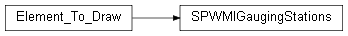
class wolfhece.RatingCurve.SPWMIGaugingStations(fromxls: str = '', idx: str = '', plotted: bool = True, mapviewer=None, need_for_wx: bool = False)[source]
Bases: wolfhece.drawing_obj.Element_To_Draw
Base class of element to add into WolfMapViewer or another GUI
-
mystations: dict[int:gaugingstation][source]
-
myrivers: dict[source]
-
gaugings: SPWGaugings[source]
-
hrefs: SPWhrefs[source]
-
plot(sx=None, sy=None, xmin=None, ymin=None, xmax=None, ymax=None, size: float = 10.0)[source]
Plot data in OpenGL context
-
find_minmax(update=False)[source]
Generic function to find min and max spatial extent in data
- examplea WolfMapViewer instance needs spatial extent to zoom or test if
element must be plotted
-
_plot(sx=None, sy=None, xmin=None, ymin=None, xmax=None, ymax=None, size: float = 10.0)[source]
-
class wolfhece.RatingCurve.SPWDCENNGaugingStations(fromxls: str = '', idx: str = '', plotted: bool = True, mapviewer=None, need_for_wx: bool = False)[source]
Bases: wolfhece.drawing_obj.Element_To_Draw
Base class of element to add into WolfMapViewer or another GUI
-
mystations: dict[int:gaugingstation][source]
-
myrivers: dict[source]
-
gaugings: SPWGaugings[source]
-
hrefs: SPWhrefs[source]
-
plot(sx=None, sy=None, xmin=None, ymin=None, xmax=None, ymax=None, size: float = 10.0)[source]
Plot data in OpenGL context
-
find_minmax(update=False)[source]
Generic function to find min and max spatial extent in data
- examplea WolfMapViewer instance needs spatial extent to zoom or test if
element must be plotted
-
_plot(size: float = 10.0)[source]